SAWYER RANCH
NOGAL, NEW MEXICO, U.S.A.
PROJECT STATUS | COMPLETED
PROJECT BACKGROUND
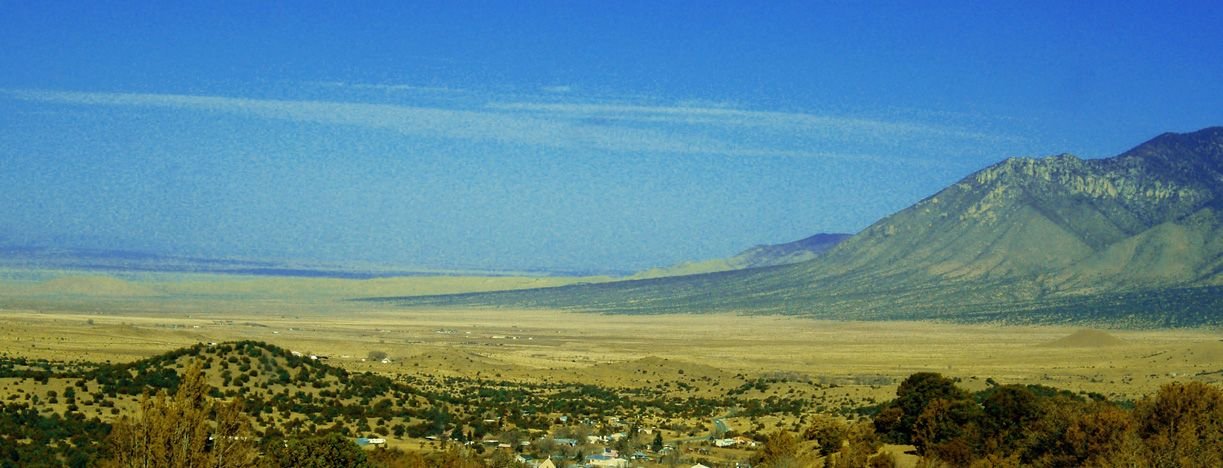
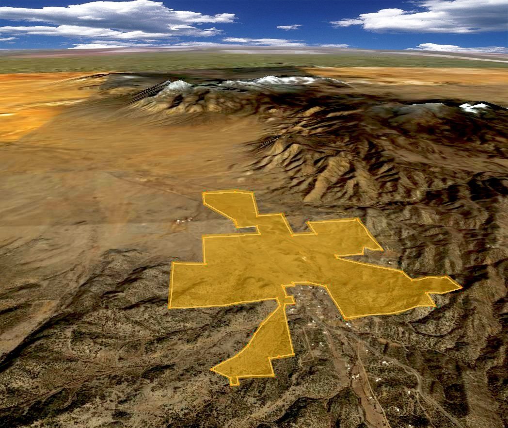
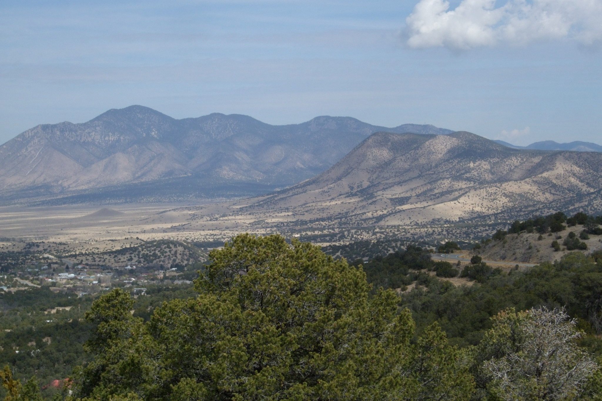
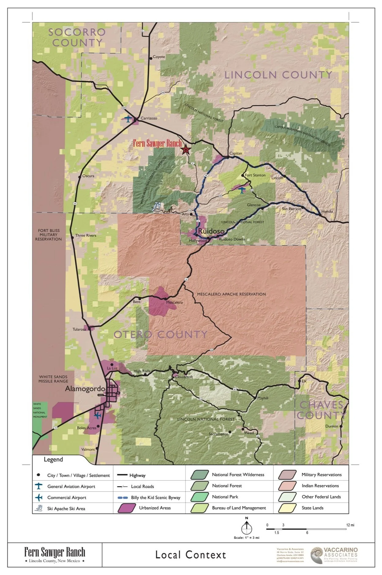
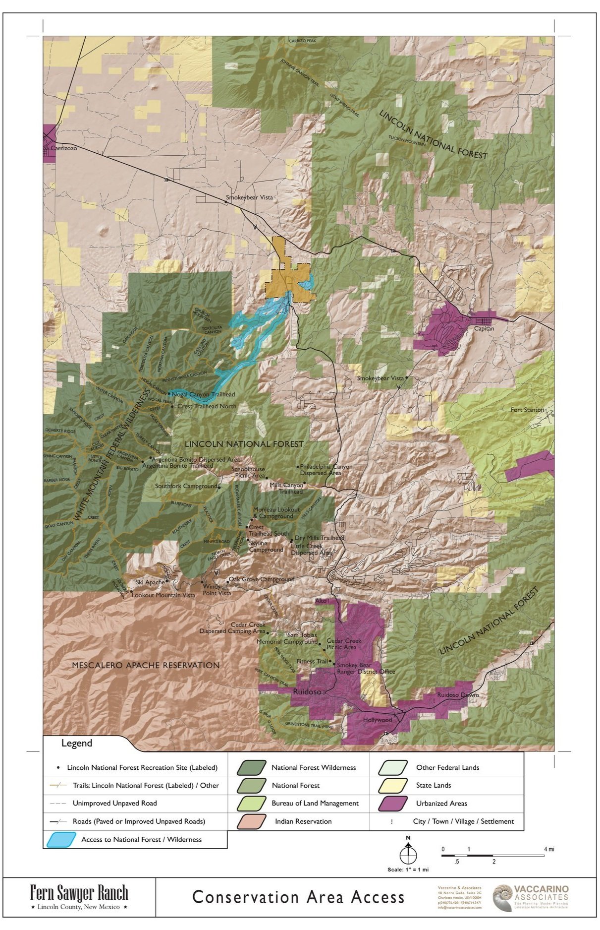
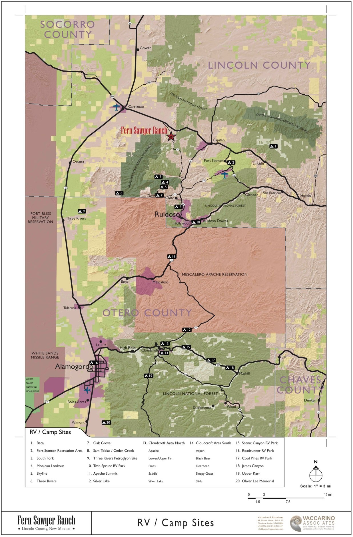
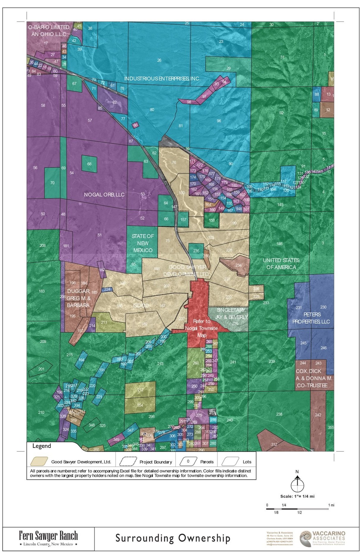
Nogal, New Mexico, is a quiet village in Lincoln County, set in the northern foothills of the Sacramento Mountains along the edge of the Lincoln National Forest, near the ski resort town of Ruidoso. Gold was discovered here in 1879. Surrounding the Nogal homesteads on all sides, Sawyer Ranch spans 1,460 acres and contains numerous archaeological sites that reveal the presence of significant American Indian settlements and artifacts.
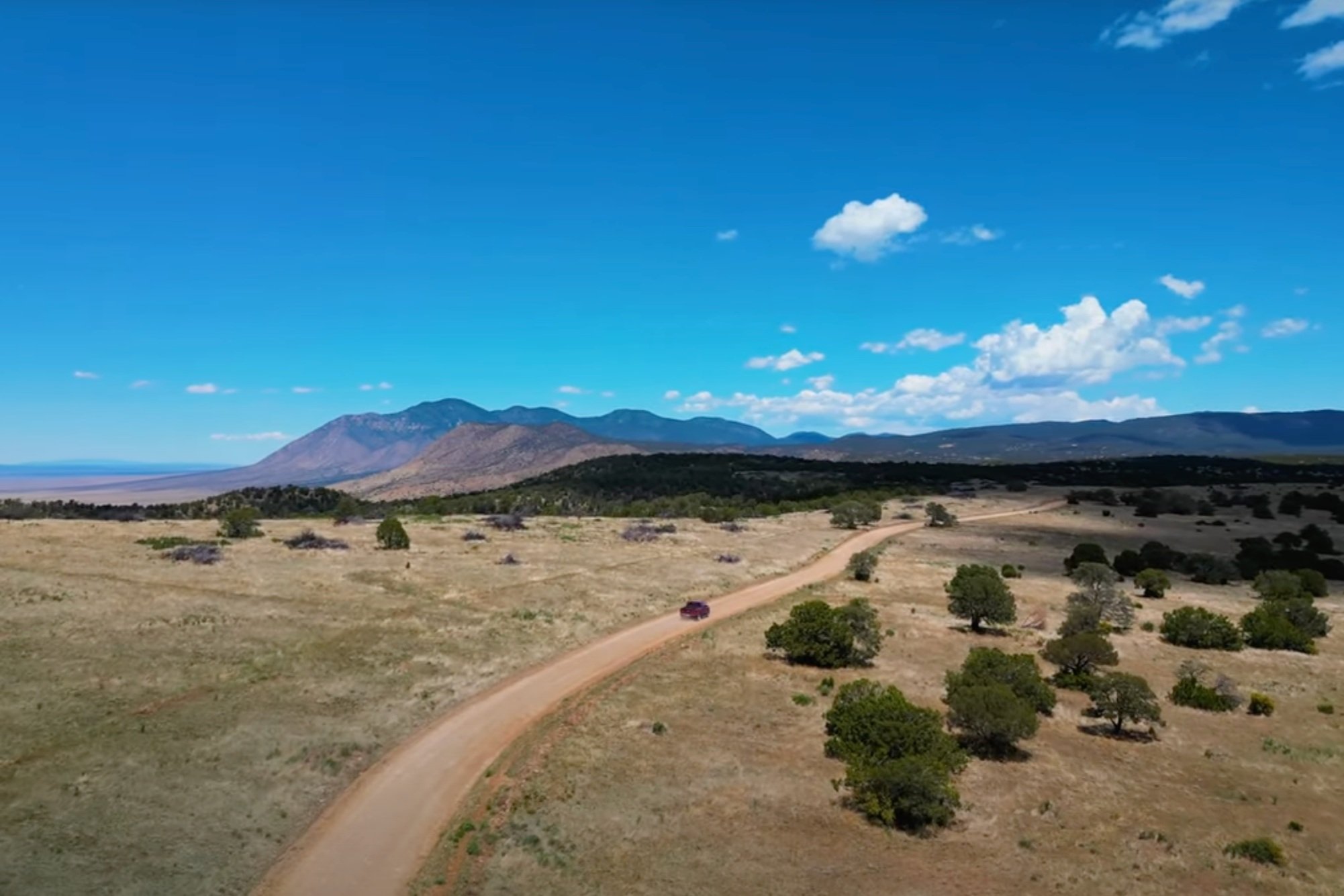


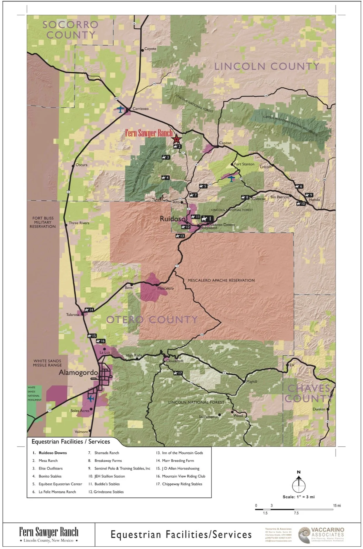
We prepared programming, site planning, town planning, building typologies, and preliminary design for a mixed-use master-planned community with equestrian amenities. The site, a valley surrounded by mountains and national forests, was formerly the ranch of Fern Sawyer—legendary horsewoman, New Mexico icon, and National Cowboy & Cowgirl Hall of Fame inductee.
The heirs of Fern Sawyer feared dividing the land into 10–20 acre lots, the only subdivision option available under local ordinance. Guided by the spirit of place, ancestral ties, archaeological sites, wildlife, and biodiversity, they embraced our recommendation to preserve large tracts as nature reserves, riding areas, and recreation space rather than fragment the property.
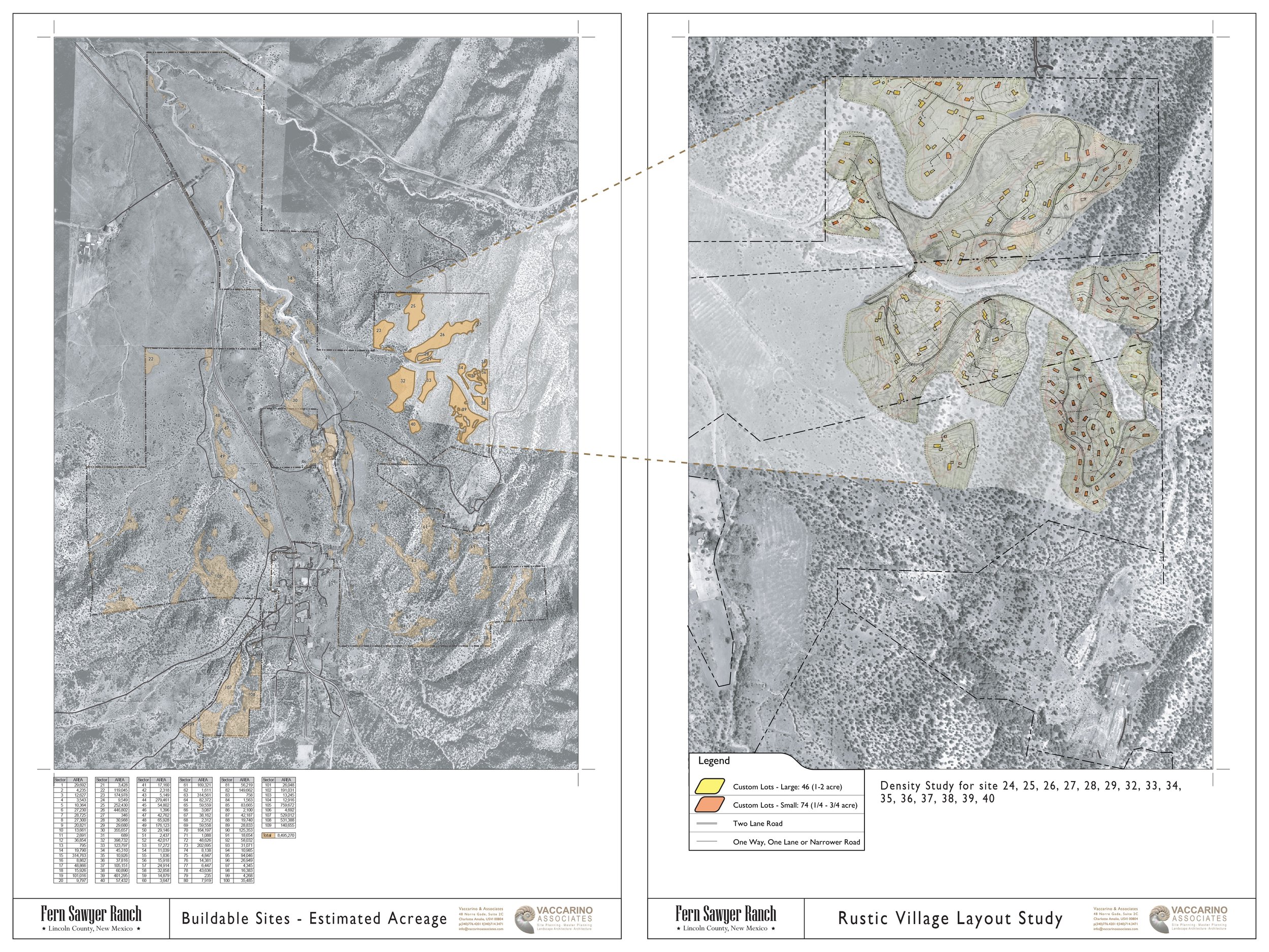
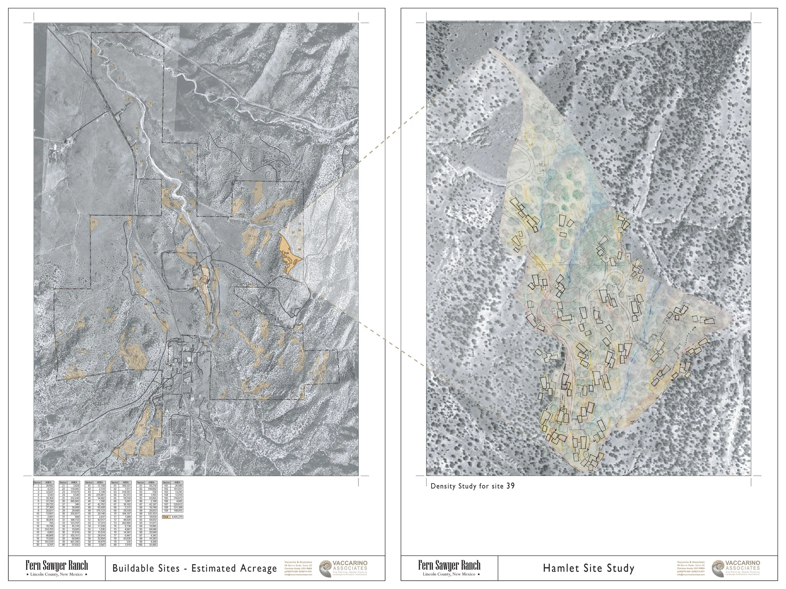
SIEVE ANALYSIS
Using our ecological planning method, we inventoried and mapped the site’s natural and cultural features requiring protection. These included land cover, hydrology, wildlife corridors, slope aspect, steep slopes, soils, archaeological sites, exposed peaks, and hilltops. Scenic values were assessed by mapping all public viewsheds from Routes 37 and 380. Areas concealed by landforms and not visible from public roads were identified as suitable for potential housing—provided no other critical constraints were present.


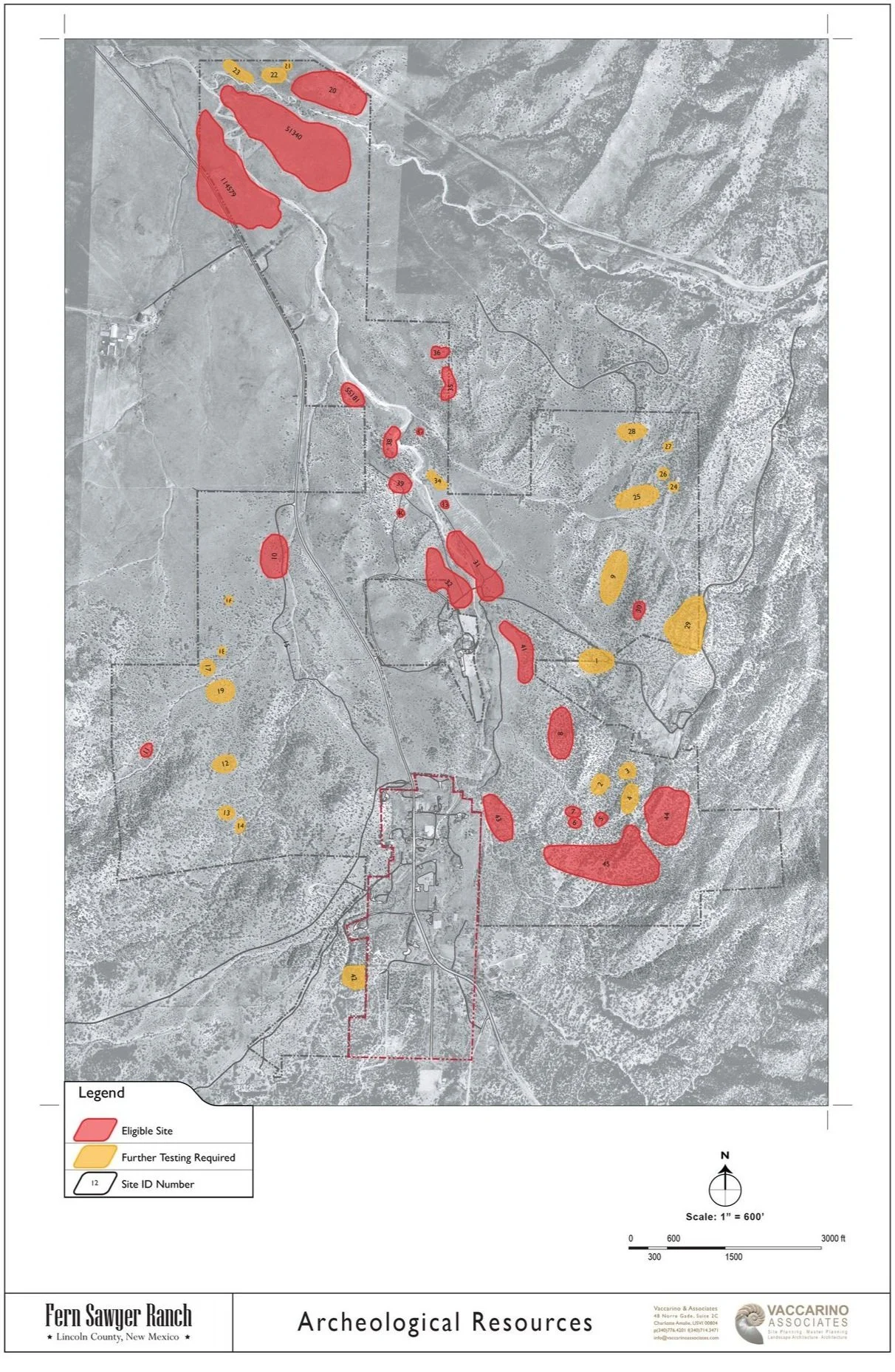


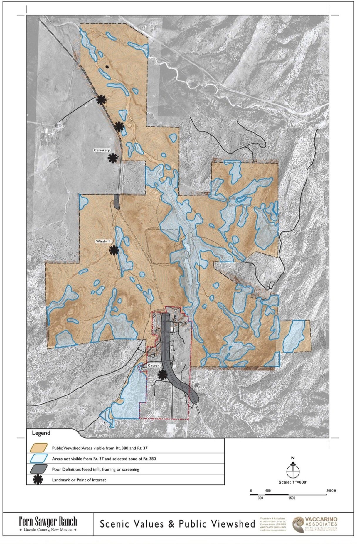


Once these maps were overlaid, we produced a synthesis map of Conservation Areas—the sensitive lands to be protected from roads and construction. Its inverse, the Buildable Areas map, revealed scattered sites suitable for development. Interestingly, these buildable zones formed fractal-like patterns across the landscape, resembling ancient settlements shaped by topography rather than imposed by roads or preconceived plans. If respected in both form and location, development could appear to have grown organically over time, in harmony with natural features—exactly the outcome we sought.
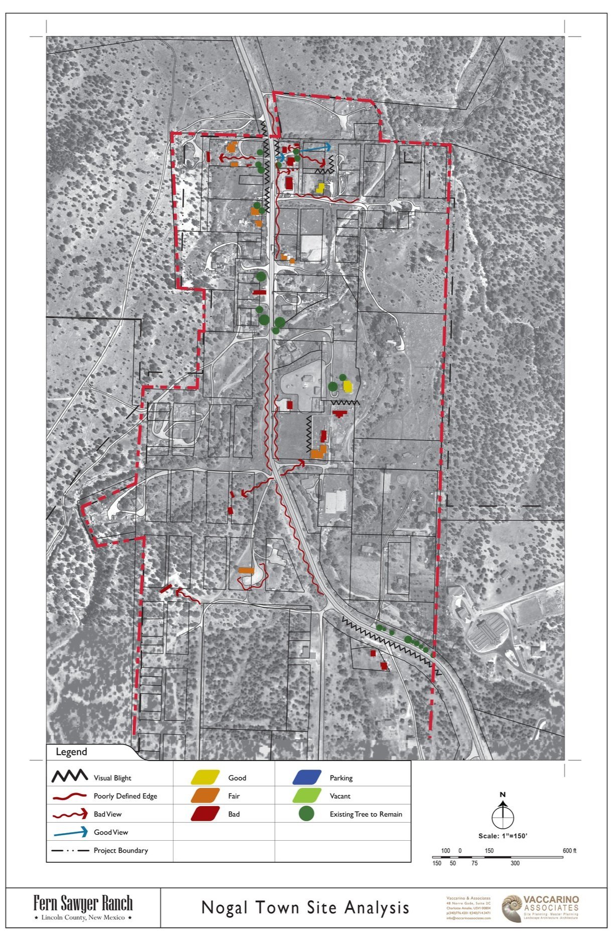
A SINERGY WITH NOGAL TOWN
Rebuilding Nogal as a viable small town with an active main street was central to the program. During our studies, several original town lots were purchased by the developer and clients to help catalyze this vision. The goal was to establish construction standards that would guide long-term urban redevelopment, revitalizing the historic main street while preventing its decline into a conventional commercial strip.


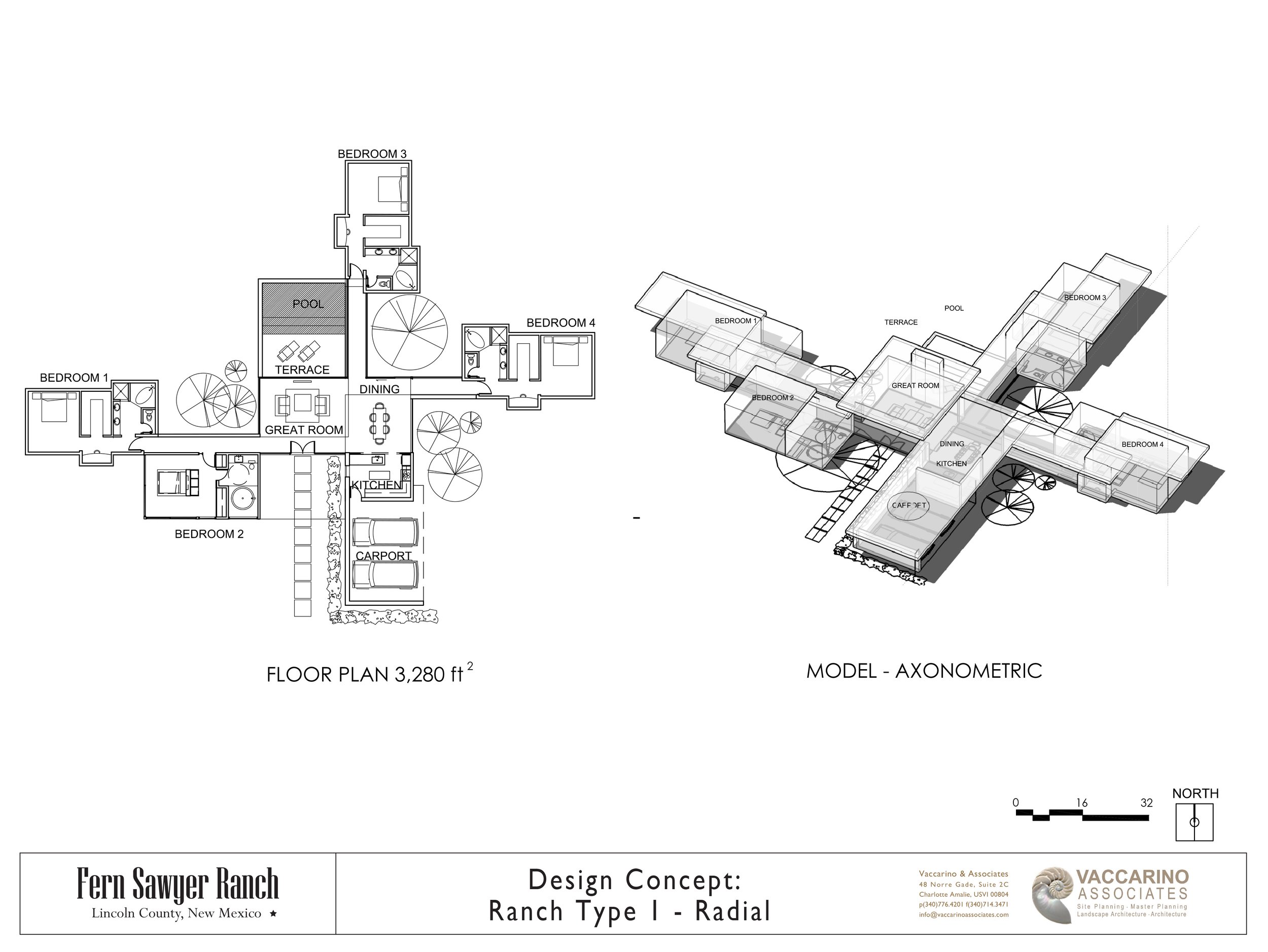
TYPOLOGY STUDIES
We conceptually designed three building prototypes—town lots, ranches on flat land, and hillside hamlets—each developed in multiple variations. Architectural precedents informed the designs, which could be applied flexibly to different site conditions. With proper funding, the owner considered prefabricating these homes in large numbers once the designs were complete.


DENSITY STUDIES
We were excited to help preserve most of the ranch land by avoiding conventional suburban sprawl. The challenge was to demonstrate to the owners and developer that clustering homes within the limited buildable areas identified in our mapping could generate revenues comparable to subdividing the entire property. Several studies across the ranch confirmed this potential. The hamlet-type homes on hilly sites proved the most challenging, with buildings closer together than many American buyers were accustomed to. Yet the shared conservation land and unique amenities offered exceptional value, giving us confidence the project could be both marketable and successful.